Welcome to today’s Worldle challenge! If you’re having difficulty identifying the country from its silhouette for December 28, 2025, this guide is here to help. We’ve prepared a series of strategic hints that will lead you toward the answer without immediately spoiling it, plus the complete solution when you’re ready.
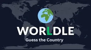
What is Worldle?
Worldle is an addictive daily geography puzzle inspired by Wordle, but instead of guessing words, you’re identifying countries from their outlines. Each day presents a new country silhouette, and players have six attempts to guess correctly.
After each guess, the game provides three pieces of valuable feedback: the distance from your guess to the target country (in kilometers or miles), an arrow pointing in the correct direction, and a proximity percentage showing how close you are. This directional guidance transforms the challenge into a geographic treasure hunt that tests your knowledge of country shapes and world geography.
How to Play Worldle
The gameplay is simple but requires solid geographical knowledge. You start by examining a country’s silhouette displayed as a dark shape against a light background. The outline is shown at a consistent scale, though it may be rotated to increase difficulty.
You have six guesses to identify the correct country. After each attempt, you receive feedback including the distance between your guess and the target, a directional arrow pointing toward the answer, and a proximity percentage. Using these clues strategically, you can narrow down possibilities and home in on the correct country.
The game resets daily at midnight, giving geography enthusiasts a fresh puzzle to solve. Success requires recognizing distinctive country shapes, understanding continental and regional layouts, and using directional clues intelligently to eliminate options.
Worldle Hints for December 28, 2025
Let’s work through some progressive hints to help you identify today’s country. These clues start general and become more specific, so stop reading whenever you’re ready to guess!
Hint #1: Continental Location
Today’s country is located in Africa, specifically on the western coast of the continent facing the Atlantic Ocean.
Hint #2: Regional Context
This is a West African nation, positioned along the Atlantic coastline between Senegal to the north and Guinea to the south and east.
Hint #3: Size and Type
This is a relatively small country, one of the smallest nations in mainland Africa both by land area and population.
Hint #4: Coastal Features
The silhouette reveals a country with a jagged, irregular coastline featuring numerous islands and inlets. The Bijagós Archipelago is a distinctive geographical feature.
Hint #5: Colonial History
This nation was a Portuguese colony and gained independence relatively recently in 1974, following a protracted liberation war.
Hint #6: Name Structure
The country’s name consists of two parts joined by a hyphen, with the second part distinguishing it from a larger neighboring nation with a similar name.
Hint #7: Capital City
The capital is Bissau, a port city located on the Geba River estuary. The country’s name actually incorporates the capital’s name.
Hint #8: Geographic Details
The country covers approximately 13,948 square miles and has a distinctive shape with a deeply indented coastline. It’s bordered by Senegal to the north and Guinea to the south and east.
Worldle Answer for December 28, 2025
Ready for the answer? Here’s today’s Worldle solution:
The Worldle answer for December 28, 2025 is Guinea-Bissau.
About Guinea-Bissau
Guinea-Bissau is a small West African country located on the Atlantic coast, covering approximately 13,948 square miles. Despite its modest size, the nation features diverse geography, rich biodiversity, and a complex history that has shaped its modern identity.
Geography and Climate
Guinea-Bissau’s geography is characterized by a low-lying coastal plain that rises to a savanna-covered plateau in the interior. The coastline is heavily indented with estuaries, mangrove swamps, and over 80 islands that make up the Bijagós Archipelago. This unique coastal landscape makes the country’s silhouette quite distinctive in shape.
The Bijagós Archipelago is particularly significant, both geographically and ecologically. These islands, scattered across approximately 4,000 square miles of ocean, are designated as a UNESCO Biosphere Reserve due to their exceptional biodiversity. The archipelago is home to hippos, crocodiles, sea turtles, and numerous bird species.
The country’s major rivers include the Geba, Corubal, and Cacheu, which flow westward to the Atlantic. These waterways and the coastal wetlands create vital habitats for wildlife and support local fishing communities. The terrain gradually rises from sea level at the coast to about 1,000 feet at the highest points in the interior.
Guinea-Bissau experiences a tropical climate with distinct wet and dry seasons. The rainy season runs from June to November, bringing heavy monsoon rains, while the dry season lasts from December to May, influenced by dry Harmattan winds from the Sahara.
History and Independence
The region that is now Guinea-Bissau was part of the Kingdom of Kaabu and other indigenous states before Portuguese colonization in the 15th century. The Portuguese established trading posts along the coast, primarily engaged in the slave trade for several centuries.
The country was known as Portuguese Guinea during the colonial era. The struggle for independence, led by the African Party for the Independence of Guinea and Cape Verde (PAIGC) under Amílcar Cabral, began in 1963. After years of armed conflict, Guinea-Bissau declared independence on September 24, 1973, though Portugal only officially recognized it following the Carnation Revolution in 1974.
The post-independence period has been marked by political instability, including multiple coups and periods of military rule. Despite these challenges, Guinea-Bissau has maintained its sovereignty and continues working toward political stability and economic development.
Culture and Society
Guinea-Bissau is ethnically diverse, with major groups including the Balanta, Fula, Manjaco, Mandinka, and Papel peoples. Portuguese is the official language, but Kriol (a Portuguese-based creole) serves as the lingua franca, and numerous indigenous languages are spoken throughout the country.
The country’s culture reflects a blend of indigenous African traditions and Portuguese colonial influences. Traditional music features distinctive rhythms and instruments, with gumbé being a popular genre. The nation has produced notable musicians who have gained international recognition for blending traditional and modern styles.
Traditional religious beliefs coexist with Islam and Christianity. Many communities maintain animist practices alongside other faiths, creating a syncretic religious landscape that reflects the country’s diverse cultural heritage.
Economy and Resources
Guinea-Bissau’s economy is primarily based on agriculture, with cashew nuts being the most important export crop. The country is one of the world’s top cashew producers, and the crop accounts for the majority of export earnings. Other important crops include rice, peanuts, and palm kernels.
Fishing is another significant economic activity, both for domestic consumption and export. The country’s extensive coastline and the nutrient-rich waters off the Bijagós Archipelago support abundant marine life. However, illegal fishing by foreign vessels has been a persistent problem.
The country has untapped natural resources including bauxite, phosphates, and offshore oil reserves. Tourism remains underdeveloped but has potential, particularly eco-tourism focused on the Bijagós Archipelago’s unique ecosystems.
Strategic Tips for Solving Worldle Puzzles
Want to improve your Worldle performance? Here are effective strategies:
Study regional geography: Familiarize yourself with countries in each region. West Africa has distinctive shapes, and knowing which countries are neighbors helps tremendously.
Look for distinctive features: Coastal indentations, island groups, peninsulas, and unusual border patterns are dead giveaways for certain countries.
Use directional clues strategically: The arrow is incredibly valuable. If you guess Senegal and the arrow points south-southeast, look at countries in that direction.
Pay attention to size: Small countries like Guinea-Bissau appear smaller in the silhouette. If the shape looks compact, consider smaller nations rather than large ones.
Consider coastal versus landlocked: The presence of complex coastlines immediately tells you the country has ocean access, eliminating all landlocked nations.
Learn colonial patterns: Understanding which countries were colonized by which European powers can provide context clues, especially for naming patterns.
Practice with maps: Regularly studying world maps, particularly focusing on country shapes and positions, dramatically improves your Worldle performance.
More Daily Geography and Word Games
Finished with Worldle and want more puzzles? Try these daily challenges:
Geography Games
- Globle for December 28, 2025 – Find countries using color-coded distance clues
Word Puzzles
- Wordle 1653 for December 28, 2025 – The original daily word game
- Quordle for December 28, 2025 – Four Wordles simultaneously
- NYT Strands for December 28, 2025 – Themed word connections
Music Challenges
- Bandle for December 28, 2025 – Identify songs from isolated instruments
Why Small Countries Make Challenging Worldle Puzzles
Today’s answer demonstrates why smaller nations can be particularly tricky in Worldle. While large countries like Russia, Canada, or Brazil have distinctive shapes that many people recognize, smaller countries like Guinea-Bissau require more specialized geographical knowledge.
Guinea-Bissau’s irregular coastline with its archipelago creates a distinctive but complex silhouette. The jagged edges and numerous islands might make the shape harder to recognize than a country with smoother, simpler borders. This complexity is part of what makes Worldle educational—it forces you to learn about countries you might not have studied otherwise.
Small West African nations can be particularly challenging because several countries in the region have similar sizes and coastal positions. Distinguishing between Guinea-Bissau, Guinea, Sierra Leone, Liberia, and other coastal nations requires careful attention to the specific shape and position along the coast.
The Educational Value of Worldle
Worldle serves as an excellent geography learning tool, particularly for visual learners. Unlike traditional methods that rely on memorizing lists of countries and capitals, Worldle teaches through pattern recognition and spatial reasoning. You learn to identify countries by their distinctive shapes, which creates stronger mental associations.
The game also builds understanding of regional geography. The directional feedback system naturally teaches you about continental layouts, regional groupings, and the relative positions of nations. When you learn that Guinea-Bissau is between Senegal and Guinea, you’re building a mental map of West Africa.
Each puzzle introduces or reinforces knowledge about different parts of the world. Countries you might never have thought about become familiar through repeated exposure. This organic learning process makes geography education feel like exploration rather than study, which is more effective and enjoyable.
Final Thoughts
Today’s Worldle featuring Guinea-Bissau provided an excellent test of geographical knowledge, particularly for those less familiar with West African nations. The country’s distinctive coastal shape with its archipelago makes it recognizable once you know the region, but it can be challenging if your initial guesses take you to other continents.
Guinea-Bissau’s unique geography, rich biodiversity, and complex history make it a fascinating country to learn about. Whether you identified it quickly from the silhouette or needed directional clues to narrow down the region, we hope this puzzle expanded your appreciation for this small but significant West African nation.
Did you solve today’s Worldle? How many guesses did it take? Each daily puzzle is an opportunity to become more familiar with our world’s incredible geographic diversity and learn about countries you might not encounter in everyday life. Come back tomorrow for another country silhouette challenge!
Happy guessing, and see you for tomorrow’s Worldle puzzle!